Twenty Villa Authors, One Coastal Framework
Cross-cultural masterplanning establishes a spatial governance framework in which independent international and domestic architectural practices design separate plots within a continuous landscape. Shared ecological and volumetric rules give those commissions a common ground. Each practice retains authorship over its villa while accepting obligations to adjacent buildings, drainage routes, vegetation, and coastal views.
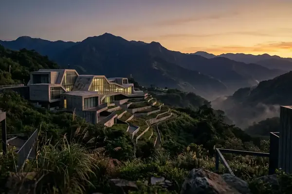
For Next-Gene 20 in Taiwan, the central curatorial question concerns how twenty distinct luxury ecological villas can remain experimentally ambitious while forming a coherent coastal ensemble. The masterplan & vision must operate at both scales: the individual dwelling and the inhabited headland.
A single-author development can repeat a familiar architectural language across its buildings. An uncoordinated luxury subdivision leaves much of the collective result to individual plot decisions. The multi-architect exhibition model instead requires explicit agreements about where architectural independence begins and where shared environmental responsibilities take precedence.
Read the Space Between Commissions
A useful reading begins with the site plan rather than a sequence of villa portraits. The reviewer traces how neighboring plots meet, where planted ground continues, and whether circulation connects the commissions into an intelligible whole. Alternating international and Taiwanese practices across the landscape also places different design traditions in direct conversation.
This shifts attention toward adjacency. A roof becomes part of another dwelling’s outlook; a retaining structure influences the next plot’s ground conditions. The collective work emerges at these interfaces. The architects’ signatures remain legible, but their relationships determine whether the headland has a shared spatial order.
Let Drainage, Wind, and Slope Set the First Lines
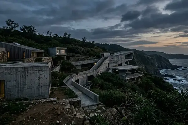
Consider an uphill villa with a broad roof projecting toward the sea. Below it, another dwelling follows a natural drainage swale. The upper building’s position affects the lower plot through runoff, outlook, and the groundworks needed to support its structure. A persuasive silhouette therefore begins with a demanding site question: where will water, wind, and excavated soil go?
Taiwan’s northeastern coastal conditions bring that question into every studio’s design process. Salt-laden air exposes exterior connections to corrosion. Seasonal typhoons place pressure on roofs, glazing, and cladding. High humidity makes drying paths important, while steep sedimentary slopes require foundations and access routes to negotiate changing levels.
Review the Ground Before the Silhouette
- Trace drainage first. Locate natural swales and follow runoff across plot boundaries before positioning building masses or retaining structures.
- Test exposure and orientation. Review roof edges, large openings, shading, and external circulation against wind pressure, wind-driven rain, and solar exposure.
- Step the section with the terrain. Coordinate floor levels and foundations with the slope, then check neighboring ocean sightlines from the principal living spaces.
These operations give visiting and local studios a shared technical baseline. An imported formal vocabulary can retain its identity through adaptation: a cantilever may change depth, a glazed opening may acquire a sheltered edge, and a terrace may step down with the ground.
View corridors belong in this same environmental review. Their protection requires sectional coordination between uphill living rooms and downhill roofs. Which early massing decision preserves both the coastal outlook and the drainage route beneath it?
Translate Architectural Ideas at the Material Joint
The meeting of a concrete wall, a timber screen, and a stone drainage channel condenses the larger collaboration into a buildable junction. Each component carries a different demand: structural continuity, solar filtering, water discharge, movement, and maintenance access. Their connection reveals how an architectural idea has absorbed the conditions of its location.
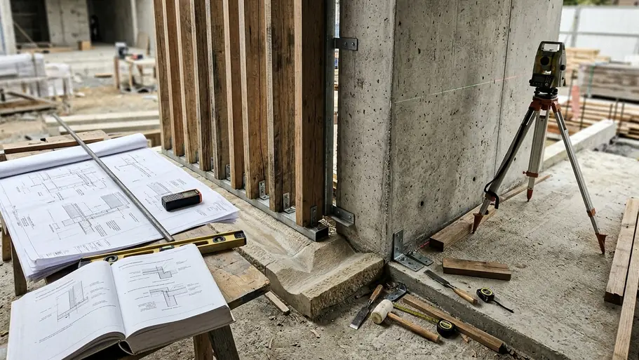
International practices may approach that junction through computational geometry, abstract tectonic diagrams, or material specifications developed for other markets. Taiwanese practitioners contribute knowledge of regional seismic requirements, monsoon waterproofing, construction sequencing, and local spatial transitions. These contributions overlap; a productive review assigns responsibility by competence and contractual role rather than nationality.
Carry Design Intent Into Contract Documents
The Design Architect defines the intended geometry, spatial relationships, and material expression. The local Executive Architect, or Architect of Record, coordinates their translation into permit-ready and construction documentation within the applicable appointment. Structured detail workshops bring those responsibilities together before drawings reach the site.
Each workshop should follow a junction through its layers. For glazing, that means moving from the visible mullion profile to seals, pressure-equalized drainage, fixing access, and the route by which collected water leaves the assembly. For board-formed concrete, the discussion extends from grain and tie-hole arrangement to reinforcement cover, mix design, formwork, and curing.
Local stonework and custom joinery can reshape the initial concept through their dimensions, tolerances, and installation sequence. The resulting hybrid gains architectural specificity when those adjustments preserve the governing idea while making its construction intelligible. A carefully resolved drainage outlet can carry as much design intelligence as the roof above it.
Write Envelope Rules Around Shared Coastal Obligations
A common roof pitch or narrow facade palette produces immediate visual repetition. Performance-based envelopes pursue coherence through a different mechanism: they regulate the consequences of each building for its surroundings. This approach suits villa designs intended to demonstrate distinct architectural positions within one ecological landscape.
The guideline writer can organize the covenant around ground, boundaries, and height. Each category needs a drawing requirement, a review responsibility, and a clear point in the approval sequence. This makes ecological integration something the project team can inspect.
- Ground disturbance: require cut-and-fill sections and an earthwork balance that favors foundations stepping with the terrain. Review retaining structures alongside drainage and neighboring ground levels.
- Boundary permeability: use planted transitions in place of solid perimeter walls. Coordinate native coastal vegetation buffers across plots so that planting forms a connected landscape rather than isolated garden margins.
- Contour-based height: measure the building envelope against the natural grade beneath it. Check roof profiles in shared sections through adjacent villas, including the outlook from uphill living spaces.
- Interface continuity: review paths, surface water, planting, and maintenance access wherever separate commissions meet. Assign responsibility for each connection before individual packages advance.
Reserve Time for Full-Scale Junctions
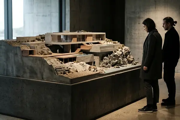
A masterplan covenant governs boundary interfaces and ecological thresholds but cannot determine a subcontractor’s execution of a bespoke junction, so project directors should reserve programme time and budget for full-scale on-site mock-up reviews.
Those reviews should bring the international and domestic teams to the same physical assembly. Concrete texture, reinforcement placement, louver fixings, glazing drainage, and stone-channel falls can then be assessed together. The mock-up turns an abstract agreement about quality into a shared construction reference.
Preserve freedom inside the envelope; demand precision where buildings meet the landscape.
Judge the Headland Across Boundaries and Through Time
The strongest assessment of Next-Gene 20 moves between the masterplan, the material detail, and the experience of occupation. For architects, developers, and scholars, coherence becomes visible through relationships that a single villa photograph leaves outside its frame.
A cross-boundary walk offers a practical starting point. The reviewer follows a pedestrian route and a stormwater path through neighboring plots, noting changes in level, planting, enclosure, and surface treatment. A continuous landscape should remain readable as ownership and architectural authorship change.
The next inspection concerns weathering. Exposed concrete, metalwork, timber, and local basalt acquire different surface characters in a subtropical coastal setting. Attention belongs at joints, drainage outlets, shaded recesses, and exposed edges, where staining or deterioration can alter the intended material relationships. Repeated observation through monsoon and typhoon seasons gives exhibitions & press a richer subject than the newly completed facade.
Finally, the assessment enters the villa. From the principal living space, the reviewer examines how the coastline is framed, how shade mediates the threshold, and how the neighboring roof or planted buffer enters daily experience. Ecological luxury takes spatial form in these ordinary encounters with exposure, shelter, distance, and ground.
Will the next multi-studio coastal masterplan enforce unity through restrictive formal codes, or let coastal climate and local craft discipline every architect’s envelope?