Every mountain project eventually reaches the same fork in the road, quite literally: bulldoze a bench into the slope, or bend the alignment until the slope accepts it. The Next-Gene 20 access grid took the second path, and almost every subsequent design decision on the site flowed from that single commitment.
What Contour-Aligned Access Actually Means
Low-impact mountain access is the deliberate alignment of infrastructure with existing geological contours in order to eliminate mass excavation and preserve native hydrology. That is the working definition, and it is stricter than it sounds. It rules out benching, it rules out speculative platform-building ahead of architectural design, and it treats the drainage behaviour of a hillside as a fixed input rather than a problem to be re-plumbed later.
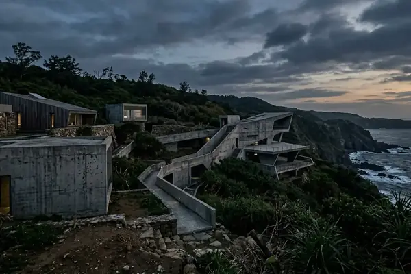
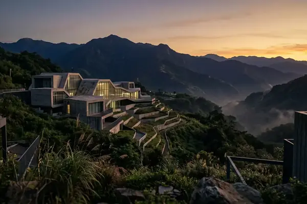
The foundational access grid at the Ao-Ti site is the clearest expression of that principle across the twenty-villa masterplan. Roads were plotted as a consequence of the terrain rather than as a precondition for it. Excavation depth was restricted to a 1.2 to 1.5-metre threshold along the entire network, and roadway widths were narrowed to 4.5 to 5.2 metres — wide enough for service and emergency access, tight enough that the cut face never becomes the dominant visual element on a slope.
Conventional mountain development does the opposite. Cut-and-fill is fast, it is cheap on paper, and it produces the flat, predictable pads that contractors prefer. The engineering team did evaluate it early, precisely because it would have accelerated the foundational grid by months. It was discarded on hydrological grounds: the volume of soil displacement required would have severed the native runoff channels feeding the lower slopes, and no downstream engineering fix restores a hydrology once it has been rearranged. Contour-aligned routing became the standing rule from that point forward.
Excavation Ceilings
A 1.2 to 1.5-metre cut limit is not a guideline on this site — it is the constraint that every alignment, gradient and turning radius had to satisfy before it reached drawing status.
Reading the Ao-Ti Slopes Before Drawing a Line
Terrain gradients across the site range from 15 to 28 degrees. Subtropical monsoon rainfall averages 2,800 to 3,100 millimetres annually. Those two figures, taken together, describe a hillside that moves water aggressively and seasonally, and they explain why the survey phase preceded the routing phase rather than running alongside it.
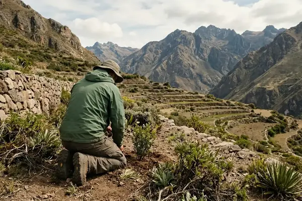
Geotechnical engineers mapped the subsurface sandstone and shale layers using ground-penetrating radar, building a stratigraphic picture of where competent rock sat close to the surface and where it fell away beneath weathered overburden. That data was then cross-referenced against historical monsoon rainfall patterns to identify the natural runoff channels already carved into the slope. Only after those channels were plotted did anyone propose an access route.
The method has a known weakness worth stating plainly. Ground-penetrating radar loses reliability where dense clay deposits attenuate the signal, and several pockets on the site required supplementary core drilling to confirm what the radar could only infer. Anyone adopting this workflow elsewhere should budget for that redundancy rather than assume a clean radar profile across the whole parcel.
Layered onto the geotechnical work was the programme itself: a single unified grid serving twenty distinct architectural visions, each by a different international practice, each with its own siting logic and entry sequence. The ecological mandate could not be negotiated per plot. Either the grid absorbed twenty sets of requirements within the same excavation ceiling, or the mandate was decorative. How many masterplans quietly relax their own standards at plot nineteen?
Twenty Footprints, One Grid: Routing by Negotiation
The routing phase was iterative and slow by design, consuming six to eight months before the access grid was finalised. Masterplan engineers overlaid the topographical survey with the twenty architectural footprints and then adjusted driveway access points repeatedly, plot by plot, until each villa's entry threshold matched the natural elevation of the road at that point.
The payoff from that tedium is structural. When a driveway meets a road at grade, there is no elevation discrepancy to resolve, and therefore no secondary retaining wall. Retaining walls are the hidden cost centre of hillside development: they demand deeper foundations, they interrupt subsurface flow, and they age visibly. Eliminating them at the alignment stage is cheaper than engineering them well.
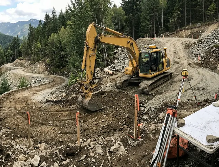
Surface treatment carried the second half of the erosion strategy. Permeable paving blocks were specified with a void ratio of 18 to 22 percent, allowing rainfall to infiltrate at the point of contact rather than accumulating into sheet flow along the carriageway. On gradients approaching 28 degrees, concentrated surface runoff is the primary erosion mechanism, and a road that sheds water sideways into the slope is a road that undermines itself within a decade. The permeable surface, combined with alignments that follow rather than cross the mapped runoff channels, keeps water dispersed and in its original paths.
This is broadly consistent with the logic behind context-sensitive solutions for mountain highway design, where alignment flexibility is traded against earthwork volume. The difference here is scale and stakes: a residential grid serving twenty villas has far more freedom to bend than a public highway, and far less excuse not to.
The At-Grade Test
Before approving any driveway, check whether the entry threshold sits within the road's natural elevation band. If it does not, the correct fix is to move the road or the entry — not to add a wall.
A Transferable Model for High-Altitude Ground Work
The completed grid was not left as a one-off solution. Project leads synthesised the network data into a standardised topographical integration model, establishing baseline metrics — excavation ceilings, width bands, void ratios, gradient tolerances, that comparable high-altitude developments can adopt without compromising structural integrity. That transferability is the more interesting output, frankly, than the road itself.
The economic argument holds up over a long horizon. Maintenance cost reductions are projected at 12 to 16 percent across a 10-year lifecycle, driven largely by the absence of retaining structures to inspect and repair, and by drainage that behaves the way the hillside already behaved. These are modelled projections rather than post-occupancy measurements, and a decade of monsoon seasons will test them properly. The aesthetic argument needs no modelling: roads that sit within the strata read as topography, while benched roads read as scars, permanently.
Where the Model Travels Well
- Sites with mapped, intact runoff channels worth preserving rather than replacing
- Multi-architect masterplans where a single grid must serve heterogeneous siting logic
- Steep parcels where retaining-wall lifecycle cost outweighs the schedule savings of benching
- Jurisdictions with high annual rainfall, where surface infiltration is a design requirement rather than an amenity
One detail reframes the whole exercise. The Ao-Ti parcel sits inside the Northeast Coast National Scenic Area, on sandstone and shale formations that drop 50 to 85 metres straight toward the Pacific. At that vertical scale, a road cut of 1.2 metres is roughly two percent of the cliff's own descent — an incision the geology barely registers, which is precisely the point.